Explore the Dena’ina cultural landscape of Anchorage
Explore the
Dena'ina Cultural
Landscape of
Anchorage
The city of Anchorage was built upon the traditional homeland of the Dena'ina. While Anchorage proper was not a Dena'ina village site, many important Dena'ina cultural sites were located here. These sites are identified by red flags on the satellite photo of Anchorage.
To learn more about each site, touch any of the red flags.


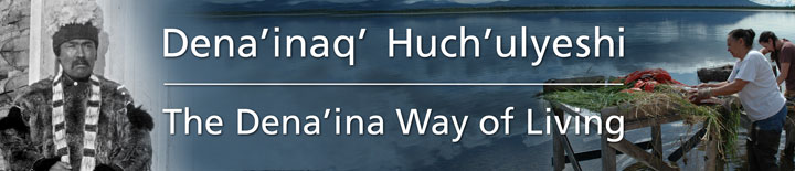
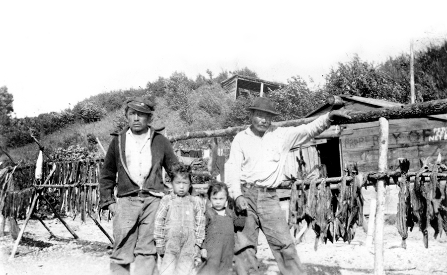
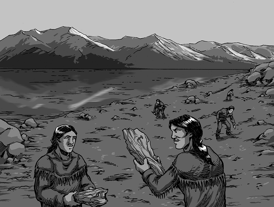
1 - Tak'at
“Dip Net Platform”
Tak'at Qenuch'en
“Across from Dip Net Platform”
The name Tak'at is a variation of the word tanik'edi, which refers to dip net platforms that the Dena'ina built of logs over the mud flats to harvest salmon. Tak'at was the northernmost site in Cook Inlet where these platforms were customarily used.
In the early 20th century, Tak'at was the fish camp for the Rufe and Annie Stephan family of Knik. The camp had three smokehouses, a steam bath, and tent frames. This camp was burned and the site used as a dump when Fort Richardson and the Elmendorf air field were constructed at the outset of World War II. Alice Theodore, Rufe and Annie Stephan's daughter recalled, “Everything was torn down. It didn't look like a fish camp anymore.”

NEAR CAIRN POINT
 Return to map
2 - Dgheyay Kaq'
“Mouth of Stickleback Creek”
In the early spring, Knik Arm Dena'ina travelled to the mouth of Ship Creek to harvest three-spine sticklebacks, also known as needlefish. These small, boney fish arrived in large numbers before the salmon runs. This resource was particularly important if winter supplies of dried fish and meat had run short.
Shem Pete said, “That was a good place to save ourselves [from starvation]. . . You just put your hand in [the creek] and it is just full of needlefish. . . They used to survive on needlefish.” Eulachon (candlefish) and, later, salmon were also harvested from camps along Dgheyaytnu. It was a busy time. Shem Pete recalled, “No one went to bed at this season, they say.”
MOUTH OF SHIP CREEK
Return to map
3 - Deggech' Dgheyay Kaq'
“Upward direction from the mouth of Ship Creek”
In 1968, National Geographic writer Bern Keating, driving back to Anchorage from the Matanuska Valley, met 70-year old Eklutna elder Bill Ezi and gave him a lift to downtown Anchorage. On the ride, Keating learned a bit from Ezi about the downtown Anchorage area in the early days.
Bill Ezi, 70-year-old chief of a 50-man village of Tanaina Indians, an Athapaskan-speaking people, had inadvertently left his new rifle at a hotel in Anchorage the night before and was hastening to reclaim it.
“Plenty good rifle,” he said. “Big rifle, .30 caliber. For years I use a single-shot .22. Big rifle better for moose and bear.”
I expressed horror at the idea of using even a semi-automatic .22-caliber rifle for shooting big game, much less a single-shot, but Chief Ezi pooh-poohed the danger. “I shoot moose or bear in the lung. He jump a little like fly bite him, but he don't even know I shoot him. He just mosey along till he drop, and he still don't know I shoot him.”
I regarded Chief Bill with considerable respect. He cannot weigh more than 120 pounds, so I asked him how he packed moose haunches in from the kill.
“I keep strong dancing.”
. . . . As Chief Bill disembarked at his modest lodgings, he thanked me and then jerked his thumb at the imposing Anchorage-Westward Hotel.
“When I am a boy, I shoot plenty animal where hotel stand. Hotel stink up hunting. Everywhere in Anchorage no good for hunting no more.”
That evening I dined 15 stories above Chief Bill's old hunting grounds.
Bern Keating, Alaska, Washington, DC: National Geographic Society, 1969.
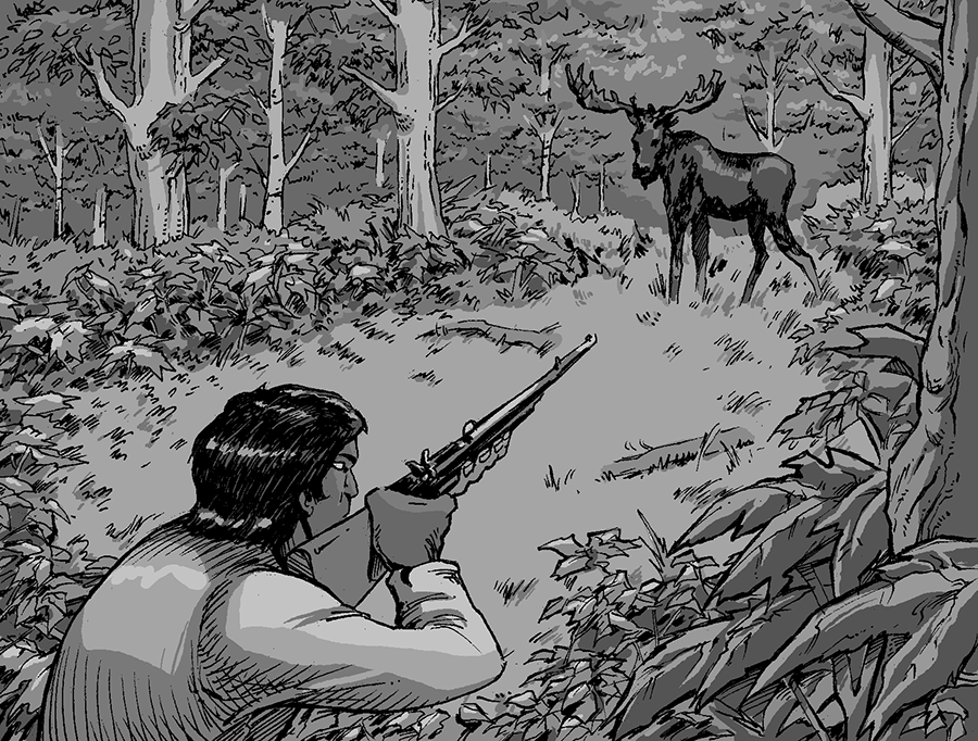
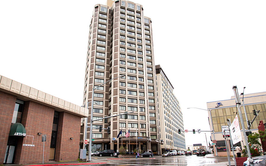
THIRD AVENUE AND E STREET
Return to map
4 - K'iłkedi Aq'a
“trapping location”
October 1969
Mr. Chairman, my name is Peter Ezi from the village of Eklutna. I am the treasurer of the village council. On behalf of the people of Eklutna, I would like to welcome you to Alaska and to Anchorage our largest city. Our village is only 26 miles from Anchorage. The Palmer Highway runs right by our doorstep. Telephone and electric lines service our village. These are all new developments in the history of Eklutna. The first white men to visit our people were the Russians. Many tourists traveling the highway stop to see our Russian Orthodox Church which is over a hundred years old, but our ancestors were here long before the building of this church.
In terms of history, then, it is only recently that the Eklutna people have given up the subsistence way of life. Our people once roamed widely over the whole Cook Inlet area and beyond in search of game and fish. Not too long ago, a father of one of my friends used to set rabbit snares right about where Fourth and Gambell cross. We had no money then, but we did have the pride of self-sufficiency. This has all changed now, for our once proud subsistence way of life has been replaced by the wardship way of life.
There has been much progress in the Cook Inlet area as Anchorage grew from a tent city to the largest city in Alaska. The people of Eklutna want to be part of that progress. But we can never make progress until we are allowed to manage our own land and affairs.
Statement of Peter Ezi, Treasurer, Village Council of Eklutna
Hearing before the Subcommittee on Indian Affairs of the Committee on Interior and Insular Affairs, House of Representatives, Ninety-first Congress First Session on H.R. 13142, H.R. 10193, and H.R. 14212, Bills to Provide for the Settlement of Certain Land Claims of Alaska Natives, and for Other Purposes.

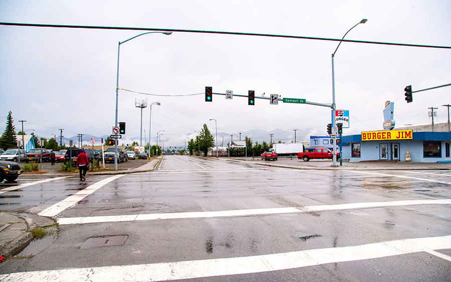
FOURTH AVENUE AND GAMBELL STREET
Return to map
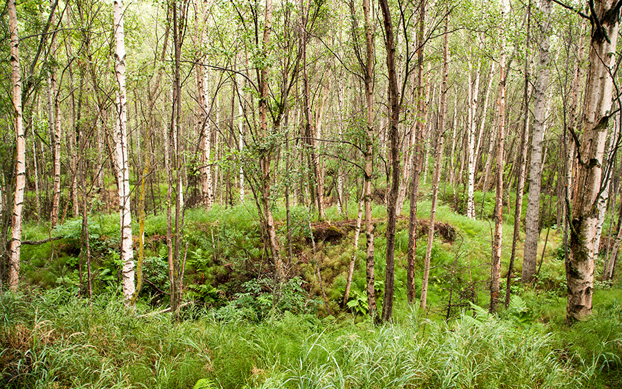
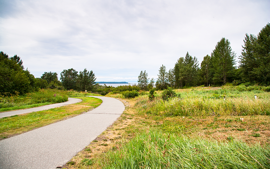
5 - Nungge
“Upland Area”
Nungge is a Dena'ina directional word for the upland direction, away from the Inlet. It may be the pre-contact Dena'ina place name for the area now known as the Nunaka Valley. It may also refer to the South Fork of Chester Creek.
The Dena'ina used the upland areas inland from Knik Arm and Turnagain Arm for hunting moose, bears, hares, porcupines, spruce grouse, ptarmigan, and waterfowl, as well as for trapping beavers and for gathering plants for food, medicines, and raw materials. The area was also used to access the Chugach Mountains, where the Dena'ina hunted Dall sheep and mountain goats.
RUSSIAN JACK PARK
Return to map
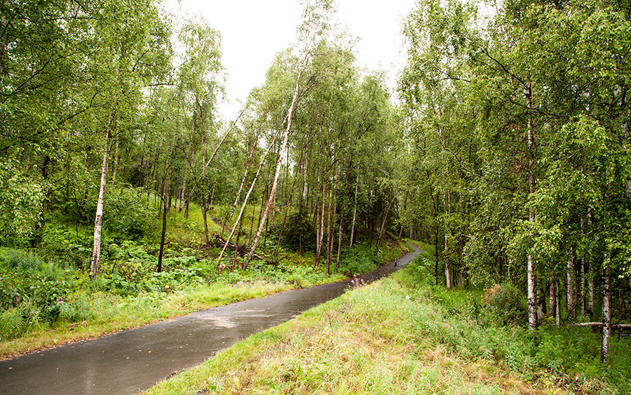
6 - Chanshtnu
“Grass Creek”
“Another place I remember stopping was at Eklutna Alex's fish camp, which was located at [the] Chester Creek area, near the end of Fifth Avenue. He had a smoke house and a summer home there. He had to move because Anchorage was becoming a city, and the land was being surveyed and sold. The original people that lived here had to move in spite of having homes there for a number of years.”
Dena'ina historian, Alberta Stephan
The Dena'ina of Knik Arm camped in spring and summer along Chester Creek to fish for salmon, and many Dena'ina had cabins and houses along lower Chester Creek during the 1920s into the 1940s. After losing their fishing sites in Anchorage, several Dena'ina families established fish camps on Fire Island.
Chanshtnu is now called “Chester” Creek. There was no Mr. Chester or Mrs. Chester for whom it was named. Instead, “Chester” appears to be the anglicized version or (mis)pronunciation of Chanshtnu.

CHESTER CREEK
Return to map
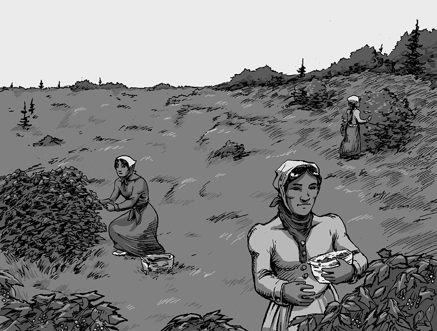
7 - Nen Ghiłgedi
“Rotten Land”
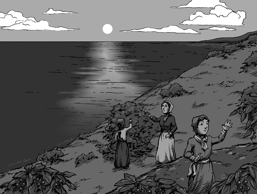
Alberta Stephan, a Dena'ina elder from Niteh and Eklutna, recalls when this area was a site for berry picking every summer by the Dena'ina who were fishing and camping at Point Woronzof.
In the 1920s and 1930s, Tyonek elder Sava Stephan spent summers in Anchorage with his grandmother. He recalled walking along the shore and bluffs in this area on the way to help with fishing at Pt. Woronzof. They harvested ducks, geese, and porcupines along the way. Sava remembered that “There were lots of Dena'ina living in Anchorage” in those decades. “They just work every day trying to get some food.”
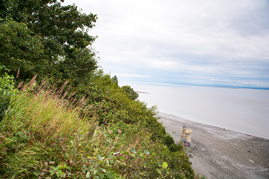
EARTHQUAKE PARK AREA
Return to map
8 - Nuch'ishtunt
“Place Protected from Wind”
Upper Cook Inlet Dena'ina from Knik Arm villages travelled to Point Woronzof in the summer to catch the returning salmon. Dena'ina elder Shem Pete stated that during the early 19th century a tanik'edi (dipnetting platform) was used in the mudflats in front of Nuch'ishtunt.
Dena'ina people camped and fished with gill nets for salmon for subsistence use and commercial sale at Nuch'ishtunt up until World War II. As Anchorage's population continued to increase, regulations closed the area, and the Dena'ina had to go to other places to fish, such as Fire Island and Point Possession.
POINT WORONZOF
Return to map
9 - Ułchena bada Huch'iłyut
“Where We Pulled up the Alutiiq Boats”
The last battle between the Upper Inlet Dena'ina and the Ulchena (Alutiit) took place in the 18th century at Point Campbell, in present day Kincaid Park. An Ulchena raiding party had crossed Portage Glacier from Prince William Sound and travelled in their open skin boats down Turnagain Arm and up Knik Arm, where they kidnapped the wife of a Dena'ina chief's son. While the Ulchena were camped at Ulchena Bada Huch'ilyut, Dena'ina warriors from Knik attacked, and rescued the woman. All but two of the Alutiiq raiders were killed. According to oral tradition, the Dena'ina instructed the two survivors to return home to Prince William Sound to tell the story.
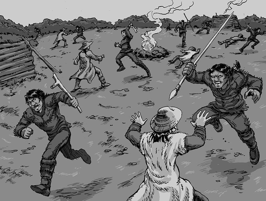
POINT CAMPBELL
Return to map
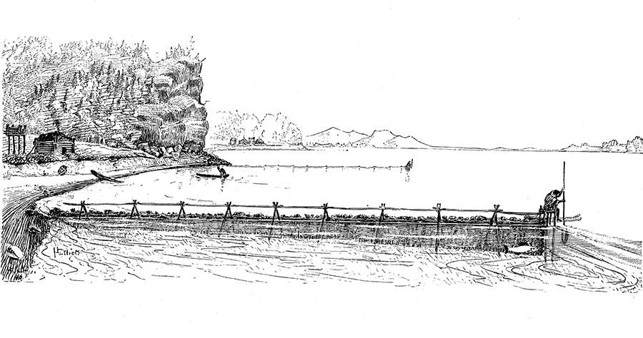
10 - Qin Cheghilnu
“Crying Ridge Creek”
In spring, the K'enaht'ana, the Dena'ina of Knik Arm, left their winter villages for fish camps along the shores and streams of present-day Anchorage, including Qin Cheghitnu, Campbell Creek. Within creeks and at the outlets of lakes, they built weirs of logs, driftwood, and willow laced with spruce roots, to funnel the returning salmon to open traps of poles or woven basket traps. They removed the salmon with spruce root dip nets, snares, spears, or harpoons.
Large quantities of salmon were processed, primarily by women, for use over winter, by drying in smokehouses or fermenting in underground caches. In bundles of forty fish, the dried salmon (baba) were transported back to the winter villages.


CAMPBELL CREEK
Return to map
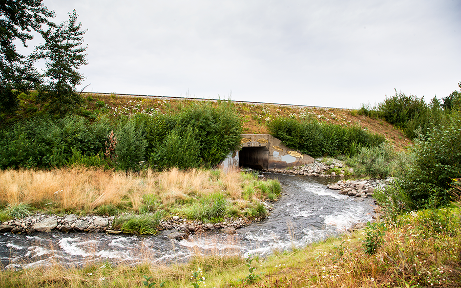
11 - Hkaditali
“Drift Lumber”
Before Potter Marsh was formed following construction of an embankment for the Alaska Railroad, the area was a tidal estuary where Rabbit Creek (Ggeh Betnu, “Rabbit Creek”) and Potter Creek (Hkaditali Betnu, “Drift Lumber Creek”) flowed into Cook Inlet. It was here, along the beach of this estuary, where the Dena'ina collected driftwood and other materials deposited by tides and storms, including lumber and planks from shipwrecks. The Dena'ina had knowledge of metal before the time of European contact, and they had a name--bel titqiz'in--for the metal that came from wooden planks that drifted to shore.
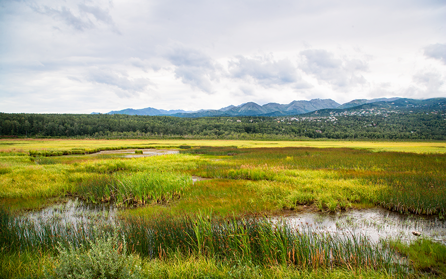
POTTER MARSH
Return to mapInteractive design by Craig Suchland. Landscape and street-view photos by Don Mohr. New illustrations by Dimi Macheras.